


Cavaleiro

rigol05
User

Length
12.3 km

Max alt
80 m

Uphill gradient
229 m
Km-Effort
15.4 km

Min alt
0 m

Downhill gradient
228 m
Boucle
Yes
Creation date :
2018-06-26 15:09:31.114
Updated on :
2018-06-26 15:09:31.114
3h26
Difficulty : Unknown

FREE GPS app for hiking
 SityTrail
IGN / Geographical institutes
SityTrail Plus
The world is yours!
About
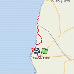
Trail Walking of 12.3 km to be discovered at Alentejo Region, Beja, São Teotónio. This trail is proposed by rigol05.
Description
sortie du 23/05
De Cavaleiro à Lapa de Pombas A/R
Dunes de sable, bois,érosion et couleurs des roches et paysages magnifiques, plein les yeux!
Positioning
Country:
Portugal
Region :
Alentejo Region
Department/Province :
Beja
Municipality :
São Teotónio
Location:
São Teotónio
Start:(Dec)
Start:(UTM)
517103 ; 4161305 (29S) N.
Comments